
BlueChart g3 microSD with SD Adaptor - Timor Leste/New Guinea

BlueChart g3 microSD with SD Adaptor - Timor Leste/New Guinea
Our Advanced Chart Offering
- Derived from official charts and private sources to provide navigational aids, spot soundings, depth contours, tides and currents, and detailed harbors and marinas
- Depth Range Shading for up to 10 depth ranges enables you to view your target depth at a glance
- Up to 1-foot contours provide a more accurate depiction of the bottom structure for improved fishing charts and navigation in swamps, canals and marinas
- Shallow Water Shading feature allows for depth shading at a user-defined level to aid in navigation
- Worldwide coverage available
- Keep your charts up to date with our industry-leading New Chart Guarantee and discount card update program
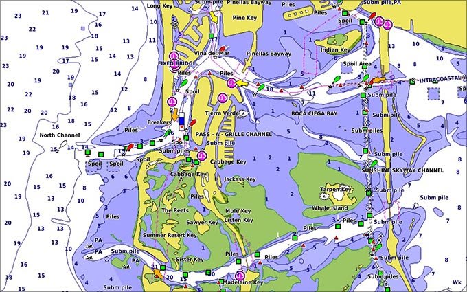
Advanced Chart Detail
Detailed charts help the mariner guide their boat in and out of port with confidence.
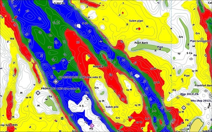
Depth Range Shading
Displays high-resolution Depth Range Shading for up to 10 depth ranges so you can view your designated target depth.
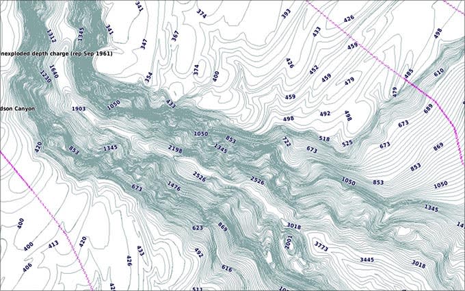
Detailed Contours
BlueChart g3 HD features 1-foot contours that provide a more accurate depiction of bottom structure for improved fishing charts and enhanced detail in swamps, canals and port plans.
Comparison:
BlueChart Feature Comparison
|
Feature |
BlueChart g3 Vision | BlueChart g3 |
|---|---|---|
| Integrated Garmin and Navionics content | • | • |
| Auto Guidance¹ technology | • | • |
| Depth range shading | • | • |
| Up to 1' contours | • | • |
| Shallow water shading | • | • |
| Raster cartography² | • | • |
| High-resolution relief shading | • | |
| Unique 3-D views | • | |
| High-resolution satellite imagery | • | |
| Aerial photos | • |
¹Auto Guidance is for planning purposes only and does not replace safe navigation operations
²Raster cartography is available for selected countries. It cannot be viewed on echoMAP CHIRP and ECHOMAP Plus combos but can be viewed on mobile devices via the ActiveCaptain mobile app
Requirements:
Download Requirements
File Information
The file size of this download and space required on your microSD™/SD™ card is 481.38 MB. It is not recommended that this download be loaded directly to your device. It only can be loaded to a prepared or blank microSD/SD card (recycled microSD cards may be used to program map data).
Up to 500 MB of additional space may be required for software updates.
microSD™/SD™ Requirements
Coverage:
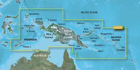
Coverage of Indonesia southeast and east of Sulawesi including Timor, all of New Guinea, the Solomon Islands, Osprey Reef, nearly all of Bathurst and Melville Islands and the Cobourg Peninsula of Australia. Ports include Ambon and Ternate in Indonesia; Snake Bay, Australia; Lae, Rabaul and Port Moresby, PNG and Honaira, SI.